


A new drought tool and more
A look at a new satellite-based drought monitoring tool.

Hello, and welcome to Western Water Notes.
Apologies for the delay in posting on here. Since I last wrote, I had a busy few weeks finishing up some reporting and research, but I have resurfaced with a newsletter this week and a few new posts in the works. Thank you to everyone who has subscribed. It’s been meaningful to see all of the support, and I’m looking for ways to carve out more time to post here more often.
The usual housekeeping before I get started:
To get all my posts in your inbox, click the button to subscribe below. This newsletter is free, but if you find my work valuable and want to support it, please consider the monthly or yearly subscription plans below. You can also support my independent journalism by sharing these posts with friends or on social media. As always, drop me a line with feedback or suggestions.
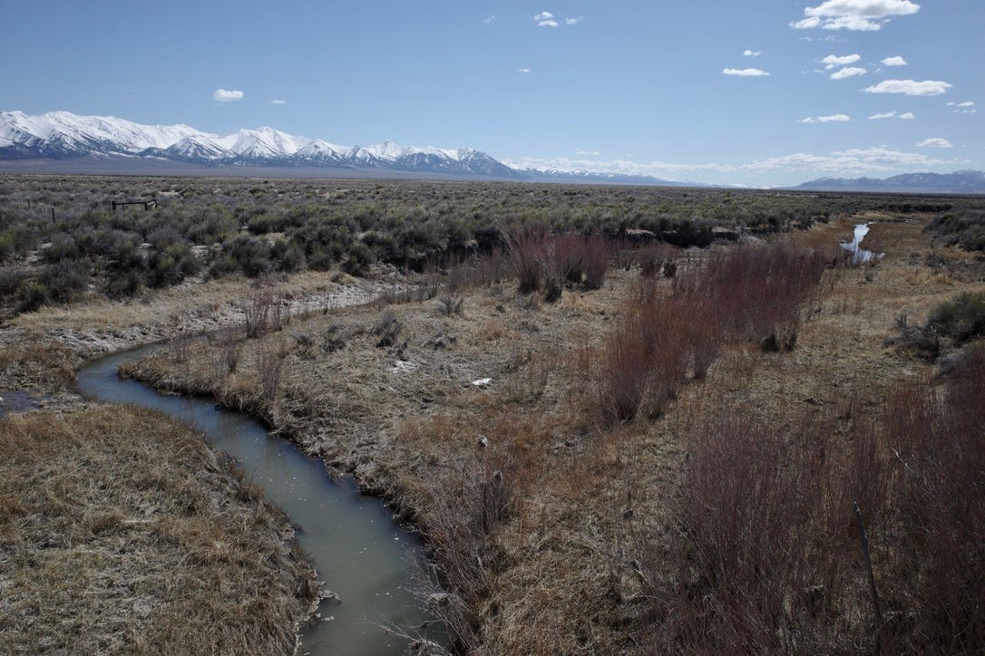
Earlier this week, I drove across the state on U.S. 50 for some reporting. Driving along what LIFE magazine dubbed the “Loneliest Road in America” offers time to think and I always spot something new, some difference that strikes from the corner of my eyes.
What stood out me on this drive were the staggering peaks that tower over the Great Basin. Covered in snow, carrying water, they made the land feel light. From the Schell Creek Range to the Toiyabe Range to the Snake Range — driving east and back west a few days later — the mountains stood in stark relief to the valleys underneath them.
They emphasized what is unique about the Great Basin: The alternating pattern of peaks and valleys, moving endlessly to the horizon. I saw water trapped near the side of the road and other spots where small puddles had a frozen finish on top of them.
But it was the snow-capped mountains that really caught my attention, reinforcing how impressive these peaks are. From the sagebrush valleys, the snow highlighted all their jagged lines and the steep elevation change that moves up from the valley floor.
Of course, the presence of snow carries significance far beyond an aesthetic beauty.
Snowpack means water.
Look at a map of the West’s snowpack, and the Great Basin is far above the average, especially central and eastern Nevada. In much of the area where I was driving, the snowpack was about 150% above the median for this time of year. That’s good news for the water supply, especially if runoff is efficient, and it also means drought relief.
According to the U.S. Drought Monitor, as of March 14, California and Nevada were not experiencing any drought. That said, there are many definitions of drought, and hydrology is only one piece of the puzzle. Different types of drought can have longer lasting impacts on vegetation, crops, socioeconomics and the broader environment.
And in a West that is trending hotter and drier, conditions can change quickly.
Understanding how conditions play out on the ground can be difficult. But I wanted to highlight a tool that is filling in some of the gaps: Publicly-accessible satellite data.
Last week, the Desert Research Institute and the U.S. Bureau of Land Management announced a new project, built on the Climate Engine platform, that could help the public better assess and monitor the health of vegetation/rangeland across the West.
Here’s more from the press release:
The website provides both drought and site characterization reports that assess drought indicators and satellite-based vegetation cover and productivity over time, with data extending back to 1986 based on the Landsat satellite archive. All reports are publicly free to view and download, which builds transparency into the decision-making process.
…
The Climate Engine team partnered with NOAA’s National Integrated Drought Information System (NIDIS) to provide multiple drought indicators at higher spatial resolution than what is available through the U.S. Drought Monitor. Users of the new site will see both long-term (up to 5 years) and short-term (up to 9 months) drought information that combines several drought monitoring indices into a single map at decision-relevant scales.
Some other threads I’m watching:
A few updates on mining in the Great Basin:
The U.S. Bureau of Land Management released a draft Environmental Impact Statement for the Robertson Mine, part of Nevada Gold Mines’ mining in the Cortez District south of Beowawe, Nev. Here’s a link to the document.
The federal government also announced a massive $2.26 billion loan for Lithium Americas’ Thacker Pass project in Humboldt County.
E&E News’ Camille von Kaenel looks at how California is trying to protect wetlands in light of the U.S. Supreme Court’s Sackett/Clean Water Act decision last year.
What is the federal government hiding? Voice of San Diego had to sue to get a copy of a document outlining what is wrong with a broken sewage treatment plant on the U.S.-Mexico border. What it got back was very redacted. More from MacKenzie Elmer.
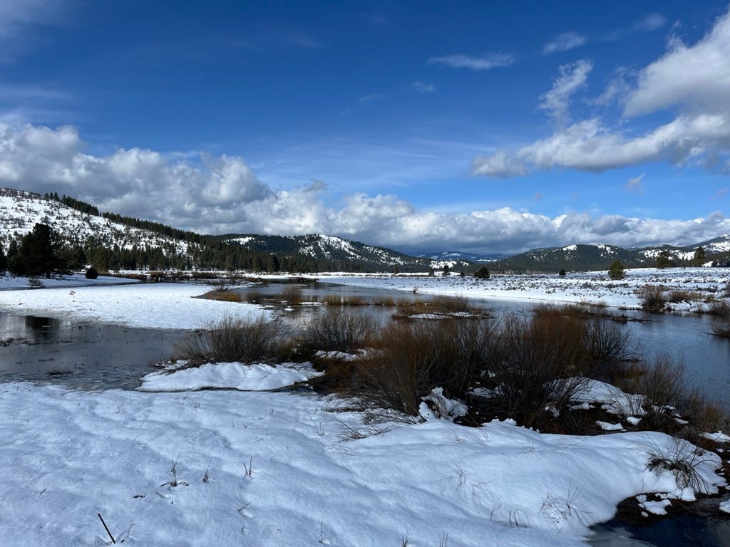
The Nevada Current’s Jeniffer Solis with more on the turnaround this winter:
Following a four-day blizzard that started on Leap Day, snowpack percentages in the eastern Sierra — a major water source for the Truckee River — jumped by a record 30%, increasing snow water content throughout its range by about 6.9 inches on average between February 29 and March 4.
By the end of the intense blizzard, all basins across Nevada had above normal snowpacks for the first time this winter, according to a winter outlook report by the Natural Resources Conservation Service. Federal data sites in Nevada recorded between 4-10 inches of additional snow water content to the snowpack in the Lake Tahoe, Truckee, Carson and Walker basins over the four days.
Also in the Current the Desert Research Institute’s Dan McEvoy breaks down how this winter has played out, looking at past El Niño winters and what warmer winters mean.
The L.A. Times’ Sammy Roth looks at the debate around dams and climate change.
Los Angeles is working on a solution — turning a landfill into a wetland — that could serve many purposes. It could help capture more stormwater, alleviate flooding and provide a neighborhood with much-needed green space. But as LAist’s Erin Stone reports, it has faced delay after delay since it broke ground about one decade ago.
KUNR’s Kaleb Roedel on UNR professor James Church and the origin of the survey tool still used to measure water content in snow: “Before Church created the Mt. Rose sampler, snowpack measurements focused on depth. His invention, however, showed how much water was in the snow and would end up in rivers and lakes.”
California Sen. Alex Padilla introduced legislation to make permanent a program that helps households pay for rising water rates, the L.A. Times’ Ian James reports. Rates for water, across the country, have increased in recent decades as utilities have had to make investments in upgrading old infrastructure and adapting to a changing climate.