Hello, and welcome to Western Water Notes.
To get all my posts in your inbox, click the button to subscribe below. This newsletter is free but if you find my work valuable and want to support it, please consider the monthly or yearly subscription plans below. You can also support my independent journalism by sharing these posts with friends or on social media. As always, drop me a line with feedback or suggestions.
-Daniel
Visiting Death Valley today, it is hard to imagine nearly all of it once underwater. It contains the lowest point in the U.S. It is known for record-setting heat and aridity.
But the land there — and many of the basins that dot the Mojave and the Great Basin — were once filled with water. During the last Ice Age, in the late Pleistocene, a lake filled much of what is now called Death Valley to a depth of about 600 feet. That’s only a bit shallower than the modern-day Lake Huron (with a max. depth of about 750 feet).
It is believed that the body of water, later described as Lake Manly, stretched 90 miles long and 11 miles wide. And it was hardly alone. Further east, in the heart of the Great Basin, Lake Lahontan and Lake Bonneville, at their peak, stretched hundreds of miles.
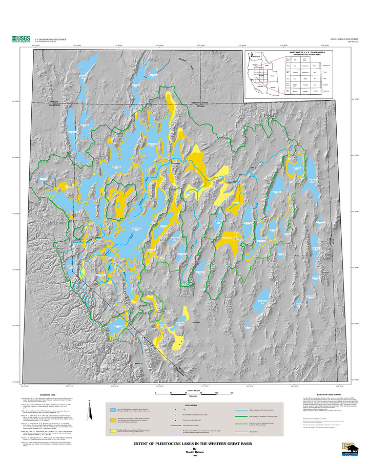
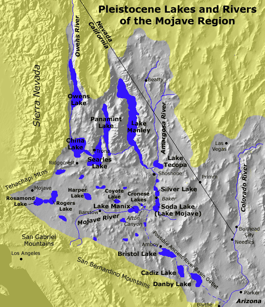
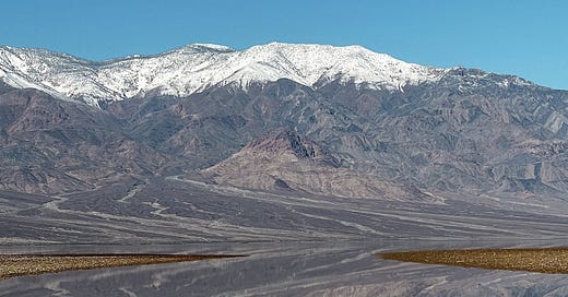
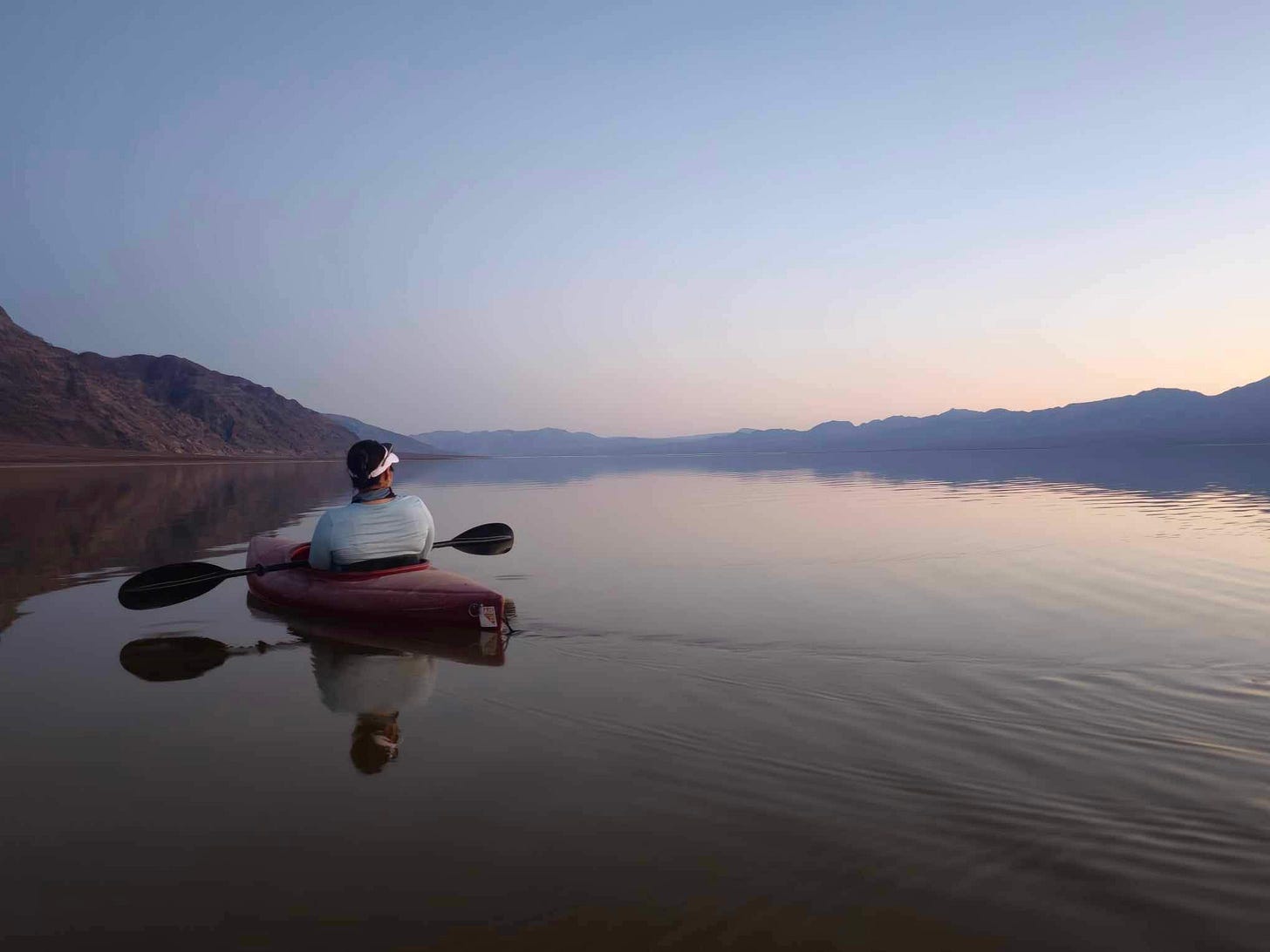
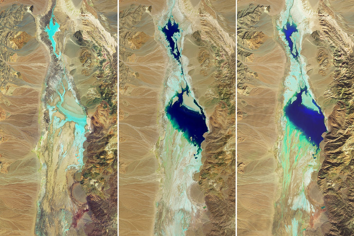
These lake systems remain etched into the landscape and topography today. And we are also getting a reminder of their presence with a section of Lake Manly returning in Death Valley’s Badwater Basin, first following Hurricane Hilary in August and then replenished by storms this month. Recently, the park welcomed kayaks onto the lake, “a rare opportunity to kayak in the driest place in the United States: Death Valley.”
The current lake is thought to be about three miles wide and six miles long. So, it is significantly smaller than it once was. Or as Giovanna Ponce, a park ranger, put it in an interview, “modern Lake Manly is a puddle compared to prehistoric Lake Manly.”
Yet in a landscape where water is so limited, the relative puddle feels like an expanse.
It is an awesome (in the most literal sense), even unworldly sight to see in the desert, a reminder of the actual dynamism of a place so seemingly fixed. A reminder of the way water flows on paths that were plotted long ago. A reminder of just how quickly, even in the driest of places, water can flood back, even after years of prolonged drought.
Lake Manly last reappeared two decades ago, and it’s a “very rare phenomenon” to see it fill like this, Ponce said. It only reappears after a major rainstorm or a flash flood. In 2004, the last time that Lake Manly appeared, Furnace Creek recorded 0.33 inches of rain before Manly filled. After Hurricane Hilary, Furnace Creek recorded 2.2 inches.
When there are intense rains, water accumulates and flows to valley floors. At 282 feet below sea level, Badwater Basin marks the lowest point in North America. But in how the lake formed, the severity of storms mattered too. If there is light rain, there might not be much flooding. But Death Valley soils are not very permeable, Ponce said. The rockier terrain means there is not much to absorb water after a hard and steady rain.
Like the rains that brought Manly’s return, the lake is not permanent.
While it’s lasted longer than officials first predicted, the lake is expected to recede as temperatures rise. Not surprisingly, Death Valley has a high evaporation rate. Ponce said the park does not expect kayaking to be possible in March. The lake should still be around past March, but shrinking as the spring and summer heat begins to set in.
As a park ranger, Ponce’s job is to guide visitors. One thing she is emphasizing these days is what the water what this says about climate change. The return of Lake Manly offers a visual for how Death Valley, despite being hot and dry, could see more storms.
“I try to get across the point that here in Death Valley, even though we're the hottest, driest, lowest place in the U.S., [according to] climate change models, we might see more frequent, more violent rain events lead to increased flash floods,” she noted.
For now, the park will probably keep getting calls about kayak reservations (they don’t have kayaks on hand. If you want to paddle on Lake Manly, you have to find one first).
“This isn't something that is a part of the normal Death Valley visitor experience. So it's odd, but it's wonderful at the same time,” she added. “And if people want to enjoy it, they will have to prepare on their own and bring their own equipment.”
More reporting on Lake Manly:
Some other threads I’m following:
“The Federal Energy Regulatory Commission announced a new policy requiring that any energy project seeking to build on tribal land must get the tribe’s approval before it will permit the project,” via InsideClimateNews’ Noel Lyn Smith and Wyatt Myskow.
In California, a lawsuit alleges that groundwater overuse is causing a new section of the Friant-Kern Canal to sink. More in this story from SJV Water’s Lisa McEwen.
In High Country News, Caroline Tracey looks at a project — fusing art and research — to document personal connections and loss in the Colorado River Delta region.
Where water goes for $74,600 per acre-foot, via Aspen Journalism’s Heather Sackett.
“A river is really the summation of the patterns created when the water flows through the landscape.” That’s from a biologist in a piece by the L.A. Times’ Ian James looking at how embracing floodplains could create healthier ecosystems and habitat.


